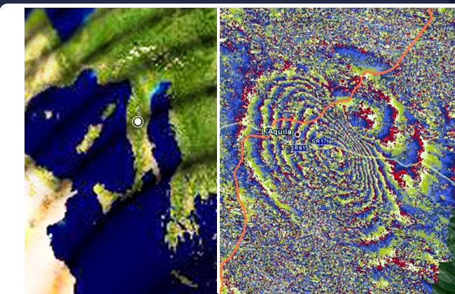
Infrasound Earthquake in L'Aquila, Italy
Satellite Interferogram of L'Aquila Earthquake
EurekaAlert.org
April 15, 2009
Studying satellite radar data from ESA's Envisat and the Italian Space Agency's COSMO-SkyMed, scientists have begun analysing the movement of Earth during and after the 6.3 earthquake that shook the medieval town of L'Aquila in central Italy on 6 April 2009.
Scientists are studying Synthetic Aperture Radar (SAR) data from these satellites to map surface deformations after the earthquake and the numerous aftershocks that have followed. SAR Interferometry involves combining two or more radar images of the same ground location in such a way that very precise measurements - down to a scale of a few millimetres - can be made of any ground motion taking place between image acquisitions.
The InSAR technique merges data acquired before and after the earthquake to generate 'interferogram' images that appear as rainbow-coloured interference patterns. A complete set of coloured bands, called 'fringes', represents ground movement relative to the spacecraft. The interferogram shows nine fringes surrounding a maximum displacement area located midway between L'Aquila and Fossa, where the ground moved as much as 25 cm (along a line between the satellite's orbital position and the earthquake area)...
Analysis
This very interesting technique used to produce the satellite interferogram provides an interesting perspective on the destructive 6.3 earthquake in L'Aquila, Italy.
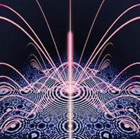
Appearing much like a giant crop circle, the interferogram presents concentric circles of impact and displacement from the epicenter. This is highly illustrative of the crucial role played by infrasound standing waves in the distribution of the energy of the earthquake event. The location of the epicenter also presents an interesting correlation with other sites of infrasound resonance that share it's distance from the pyramids of Giza, Egypt.
L'Aquila, Italy (42.37°N 13.44°E) is 1,302 miles from Giza, or 5.23% of the Earth's mean circumference distance. Due west of L'Aquila sits Rome and the Vatican at 5.3%, while the birthplace of Nikola Tesla lies to the east in Smiljan, Serbia, also at 5.3%.
Other significant sites along this circle at a resonant distance of 5.3% or roughly 1,325 miles from Giza include Petridava, in the Ukraine; Persepolis in Iran; Tassili n'Ajjer in Algeria; and Ma'rib in Yemen.
Crop circle formations appearing along this resonant band of 5.3% in Italy, in 2006 alone, included well-documented events near Montegranaro, Santa Lucia, Recanati, Castelfidardo, San Biagio di Osimo and Cartoceto. The locations of crop circle clustering along areas of infrasound resonance in Italy is detailed here.